Case study · Design + Build · 2026
Peta Budaya Probolinggo
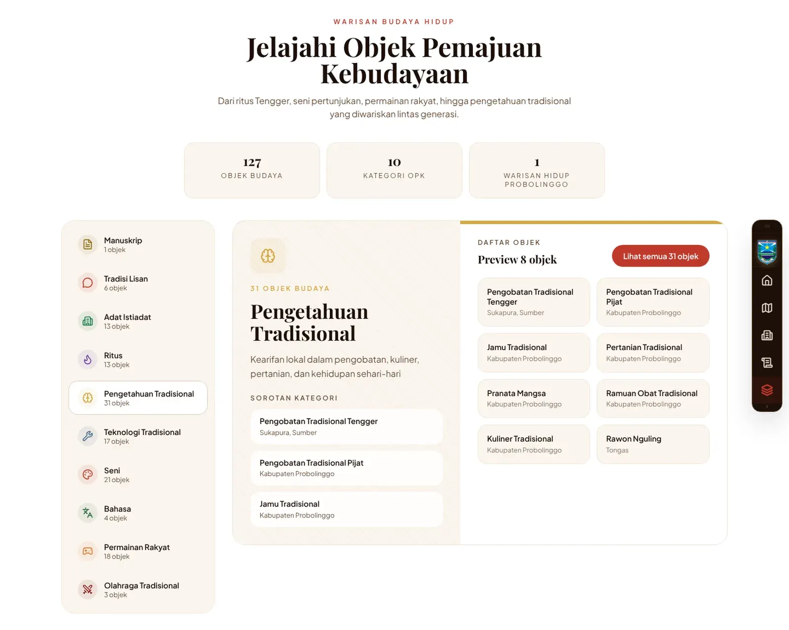
The official interactive map of cultural heritage in Probolinggo Regency, East Java: protected heritage (Cagar Budaya), intangible heritage (WBTB) and objects for advancing culture (OPK), each pinned where it really is.
In short
- Problem
- The regency's heritage data, coordinates included, lived in PDFs and spreadsheets that were hard to read.
- What I did
- Designed and built an interactive map with a pin and a page for every object.
- Result
- A public showcase of Probolinggo's culture, with 65 objects on the map.
01The problem
The culture office already had its inventory, coordinates included, but it was spread across PDF documents and spreadsheets. A table of numbers doesn't show where heritage sits or how it clusters, and it isn't something the public will browse.
02My role
I designed and built the site for the office: the map, the object pages and the content structure.
03What I built
Heritage map
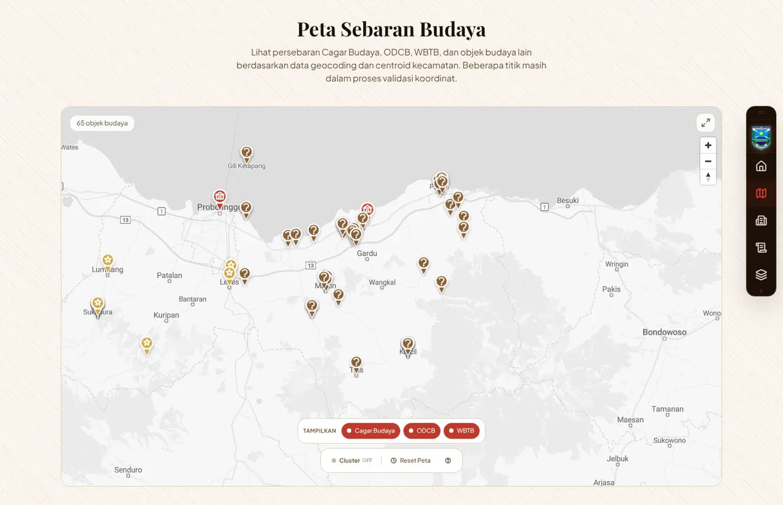
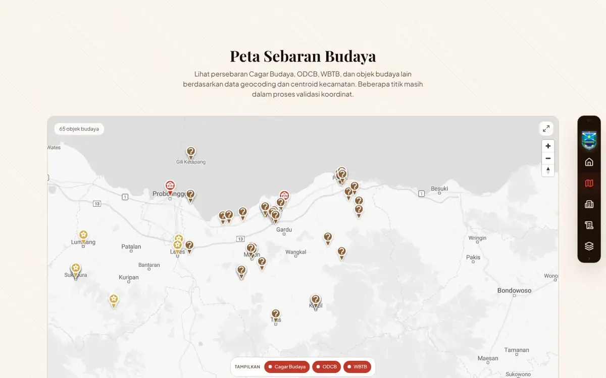
Every object pinned on one map and colour-coded by category: Cagar Budaya, WBTB and OPK.
Object pages
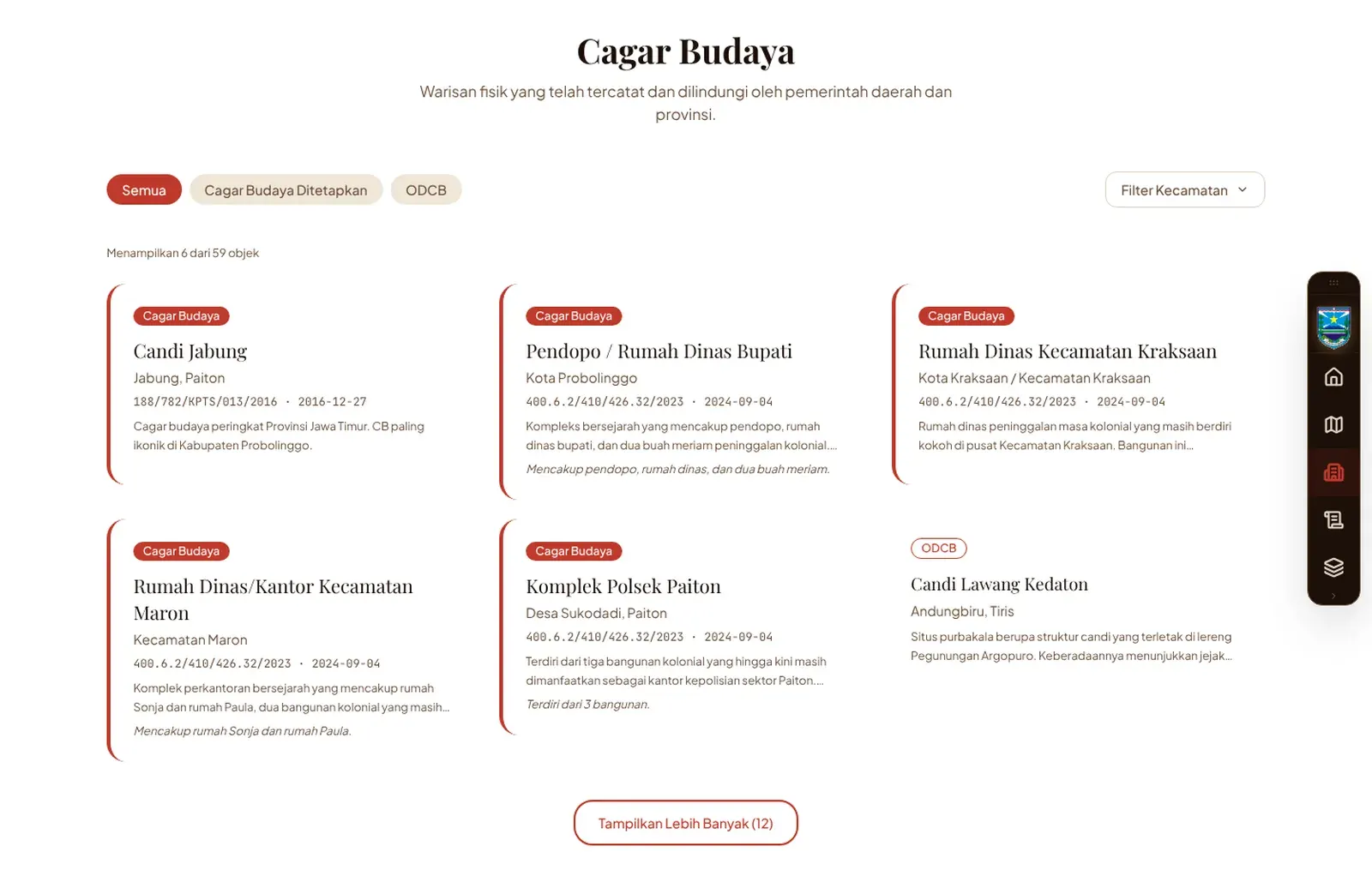
Each object gets its own page with its story, location and category.
Filters
Category chips switch layers on and off right on the map.
04Design decisions
A guide, not a GIS tool
A warm paper tone and a serif display face make it feel like a museum guide rather than a data viewer.
Navigation in a dock
A slim side dock keeps the map full-width while every section stays one tap away.
Honest data
Points still being validated are labelled as such on the map.
05Stack
- Front end
- Next.js 16, React 19, Tailwind 4
- Map
- MapLibre GL
- Motion
- Framer Motion
- Hosting
- Vercel
06Result
- Coverage
- 65 cultural objects on the map at the time of writing.
- Use
- A digital showcase of the regency's cultural inventory, replacing scattered documents.
07Visuals